Project leader:
Szabó, Brigitta
Participating researchers:
Makó, András; Bakacsi, Zsófia; Horel, Ágota; Pásztor, László; Laborczi, Annamária; Kassai, Piroska; Zsigmond, Tibor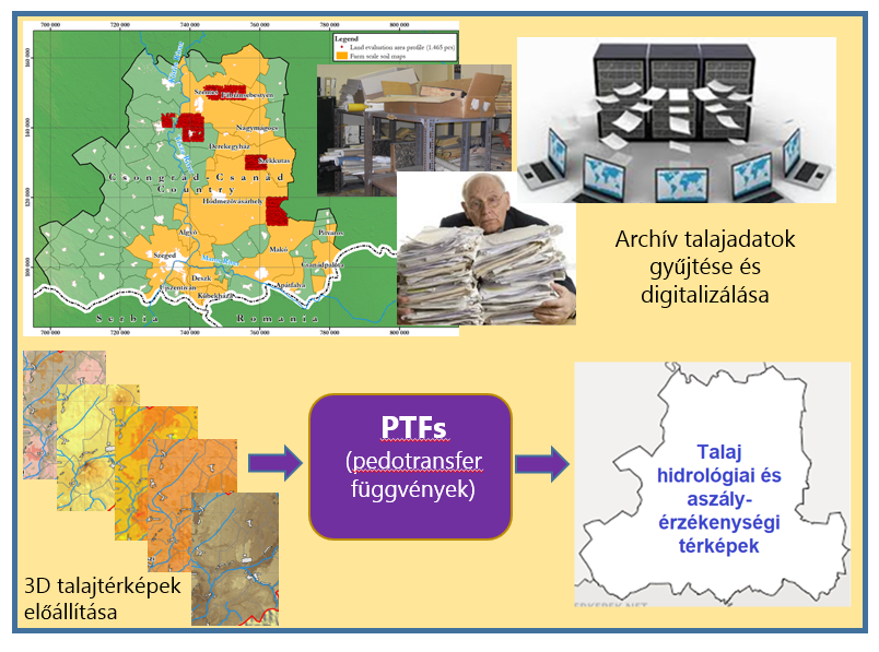

The soil hydraulic properties (such as water retention and hydraulic conductivity associated with soil pore size distribution) determine how much of the precipitation or irrigation water reaching the surface is capable to infiltrate into the soil, how much becomes runoff, and how much and how long time moisture can be stored in the soil. These fundamentally determine hydrological and biogeochemical processes occurring in the soil. Hydrological monitoring and occasional measurement of soil physical and chemical properties of a case study greatly contribute to refining the input parameters of hydrological models and validating estimation procedures.
The implementation of the planned research tasks is grounded by research projects conducted at the institute, focusing on the estimation and mapping of soil hydrological properties (KH124765, WaterJPI – iAqueduct, H2020 – OPTAIN, K48302, K119475, K134563, OTKA 101065, OTKA 131792), the results of which are particularly important in the context of climate change.
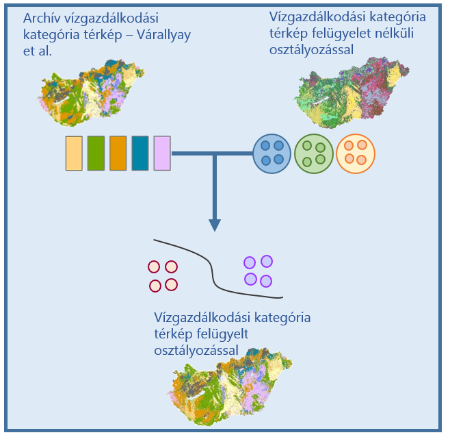
During the research, our aim is to renew the soil water management categories of Hungarian soils defined by Várallyay based on statistical analyses, building upon the results of the BO/00088/18 Bolyai Research Fellowship. This involves further development and mapping of the established soil groups complemented with expert rules. We plan to create a soil hydrophysical classification system that describes soil profiles with typical hydro-physical properties found in Hungary and ensures the data requirements for soil hydrological input in models considering soil water management. The created classification system will be supported by measurements examining the soil-plant-water system in a case study.
We are expanding the Hungarian Detailed Soil Hydrophysical Database, called MARTHA with general soil profiles and additional soil hydrological data. We investigate how the application of a model considering dual porosity refines the description of the soil water retention curve. Based on the hydrophysical data of the expanded database’s soil profiles, we define the soil water management groups using statistical methods and experts based rules. The relationship between soil water management groups and easily accessible soil properties is examined using data mining methods, and then the procedure is applied to map soil hydrological groups. The case study data are also utilized as validation points.
Through the planned investigations, we quantify how accurately the description of soil water retention can be refined for soils of different physical and soil types using models that consider both micro and macroporosity. The creation and mapping of soil hydrological groups provide crucial information for designing hydrological response units in watershed-level hydrological models. The formation of soil hydrological groups serves as important input data for national and regional analyses and planning related to soil hydrological properties, providing a comprehensive overview of soil water management characteristics.
The map of soil hydrological groups, along with soil moisture monitoring data, supports sustainable agricultural and water management planning.