Researchers with the lead of the Institute for Soil Sciences, HUN-REN Centre for Agricultural Research developed a high-resolution national “soil hydrologic groups” map for Hungary by integrating data-driven clustering with expert rules.
Using the HU-SoilHydroGrids dataset (100 m resolution, six depth layers, eight hydraulic parameters) as well as soil chemical and taxonomic maps, they first applied k-means clustering to partition soils by hydraulic behavior. Since purely statistical clustering tends to underrepresent extreme or rare soil types, they refined clusters via expert rules considering soil genetic type, rooting depth, electrical conductivity and sodium exchange content.
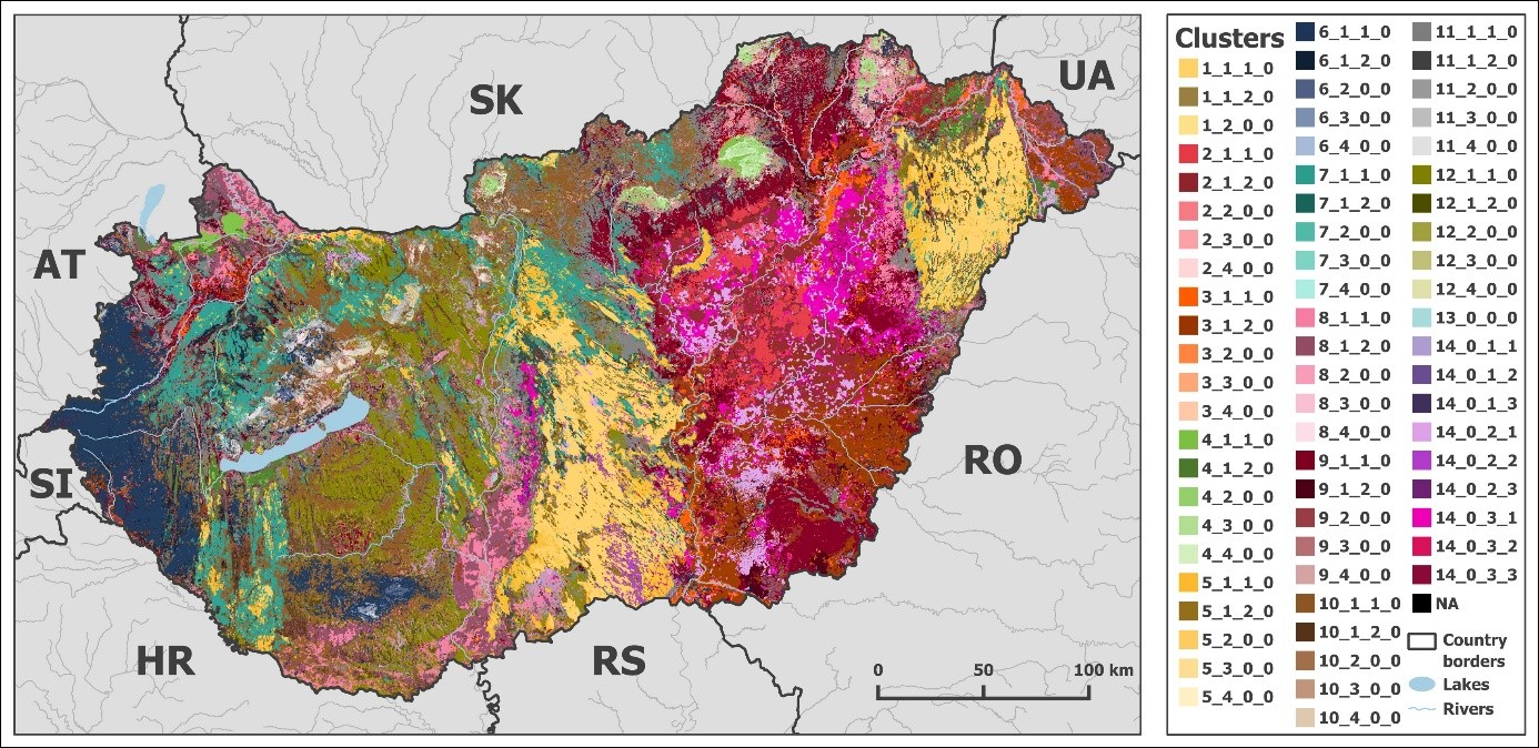
The result is 68 distinct soil hydrologic groups, each characterized by van Genuchten parameters and saturated hydraulic conductivity. They validated the grouped map using independent observations from a drought and water scarcity monitoring system, evaluating metrics like R², RMSE, bias and concordance. While aggregation reduces some accuracy, especially near saturation, the grouped map remains practical for large-scale hydrological modelling and environmental planning.
This map enables consistent treatment of soils with similar hydraulic behavior across Hungary, thus supporting watershed modelling, land use planning, drought assessment, and other environmental applications.
Tovább a cikkhez: Scientific Data