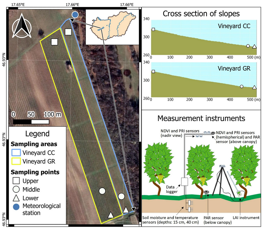
This study by Ágnes Vári and colleagues explores the socio-ecological system of Lake Balaton, focusing on how different user groups (local residents, second-home owners, and tourists) perceive and value the ecosystem services provided by the lake. Based on a survey of 1,500 respondents, the research identifies social preferences regarding recreational activities, shore types, and future development projects.
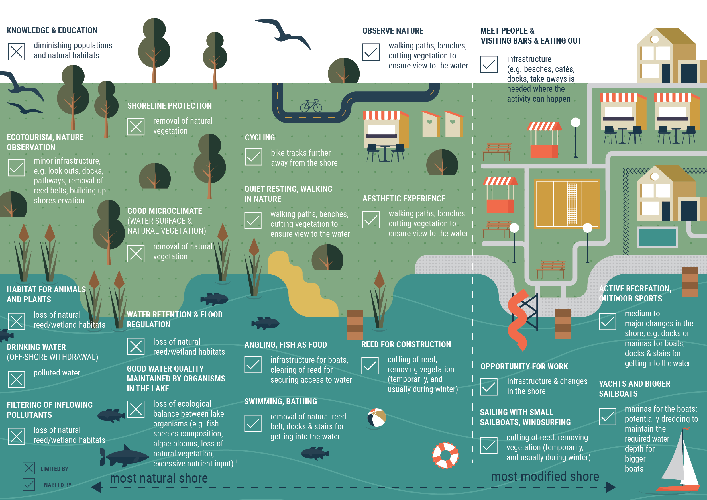
Respondents attributed the highest importance to regulating services (e.g., water quality maintenance, climate regulation) and cultural services (e.g., aesthetic beauty, quiet relaxation). This aligns with the finding that the most frequent activities are nature-based and require minimal infrastructure, such as swimming, walking, and observing wildlife. In contrast, high-impact activities like yachting or motorized water sports ranked significantly lower in importance.
The study’s most critical takeaway is that value judgments are primarily driven by environmental awareness rather than socio-demographic factors like age or gender.
-
A clear majority (58–61%) of respondents disapprove of further intensive infrastructure development, such as new hotel complexes and large marinas.
-
There is a strong preference for natural or near-natural shoreline types (reed beds, undeveloped banks) over artificial, built-up environments.
-
The most significant differences in opinion were found between local residents and tourists, highlighting how daily proximity and attachment to the lake shape perception.
The research highlights a fundamental conflict in sustainable management: the demand for mass recreation often clashes with conservation goals (e.g., Natura 2000 protection). The authors propose a framework based on spatial multifunctionality. This suggests that the shoreline should be managed through targeted spatial planning that balances protection and usage, ensuring that human activities do not compromise the natural processes—such as the filtering function of reed belts—that sustain the lake’s health.